Žabovřesky 1918–1945


The present-day district of Žabovřesky covers the area of three older villages: Žabovřesky, Maničky and Vinohrádky, situated west of Brno along the roads leading to the castle of Veveří and Tišnov. These were mainly agricultural settlements with orchards and vineyards on the slopes of Kraví Hill. Their historical buildings consisted mainly of farmsteads and workers' and craftsmen's houses alongside the roads. The first two-level houses, many of which were already urban in nature, appeared in the mid-19th century as the villages spread towards Brno.
The architecture trail starts on the hill above the historic Žabovřesky, on the city's border from 1919. The Tree Planting and Decorating Association's efforts resulted in the original farmlands being converted into an urban forest (nowadays called the Wilson Wood) in the late 19th century. The surrounding area witnessed intensive urban development even before World War I. While few houses were built below the Wilson Wood in the Svratka River valley, the top of the hill was crowned with a villa estate, the so-called Czech Officers' Quarter, which had been built as a response to the nearby predominantly German residential estates at the base of Žlutý Hill in today's Masaryk Quarter. These involved an estate with detached houses and villas freely inspired by the English garden city movement, whose promotion of a healthy lifestyle and outdoor activities influenced the housing preferences pursued by the flourishing middle classes in the early 20th century.
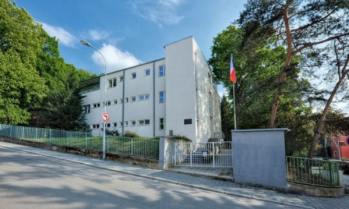
After Žabovřesky was incorporated into so-called Greater Brno, the building activities in the vicinity of the villa estate as well as alongside the main road to Brno (present-day Minská Street) increased. However, the two parts did not merge until 1922-23, when the Kounic Students' Dormitory was built and became a prominent feature on the slope above Žabovřesky and determined its urban character. The monumental dormitory tower was built at the junction of three streets leading from the main Brno road. This was also the starting point of the newly delimited street axis (present-day Březinova Street), which led up to the foot of Kraví Hill as a link to the historic road leading from Old Brno (present-day Údolní Street). While block development continued in the area below the Kounic Students' Dormitory, a more freely conceived residential estate with villas, detached and semi-detached houses and small apartment buildings spread across the slopes above. The activities of several housing cooperatives, which were also engaged in building projects in the neighbouring Masaryk Quarter, resulted in the creation of today's Kameníčkova and Sirotkova streets and Tůmova, Zábranského and Lužická streets on the opposite side in the 1920s.
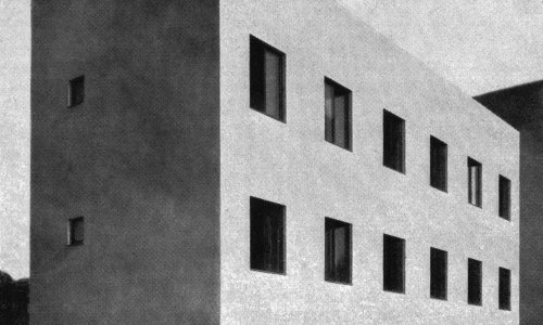
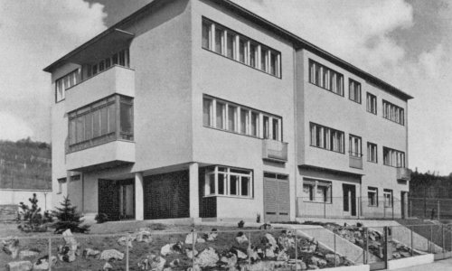
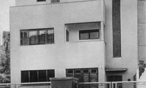
The area below Wilson Wood witnessed the first urban development simultaneously with the side of Kraví Hill. The older thin development welcomed new and mainly detached and semi-detached houses alongside today's Šmejkalova Street, which became the street axis leading from the Brno road (present-day Burianovo Square) as far as the edge of the wood. In 1928, in connection with the Exhibition of Contemporary Culture held at the Brno exhibition centre, part of this location was chosen to present a set of standardised residences, the so-called New House estate, displaying the latest and, at the same time, affordable individual housing for the middle classes. The sixteen residences were divided into groups and situated along the perimeter of a wedge-shaped area with a shared inner park and playground (between present-day Šmejkalova, Bráfova and Jana Nečase streets).
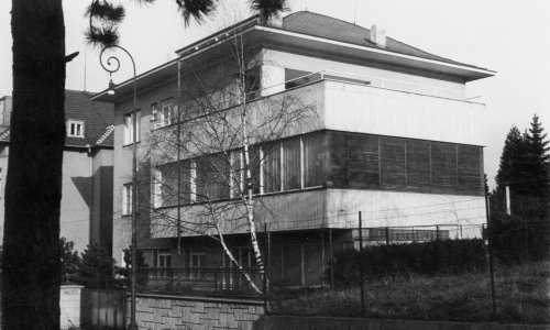
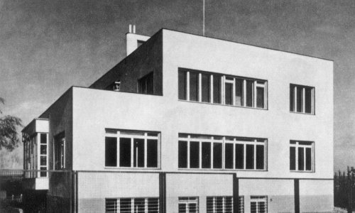
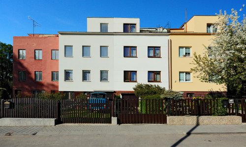
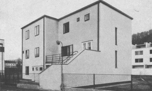
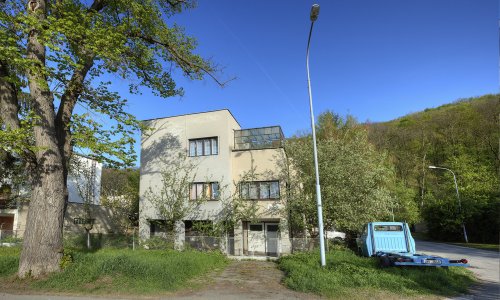
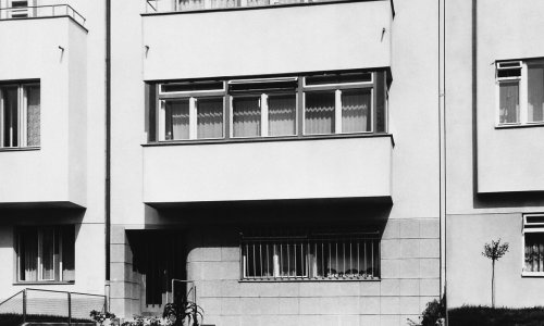
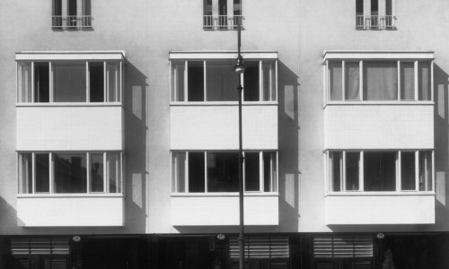
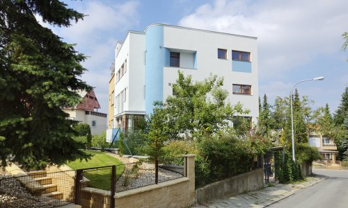
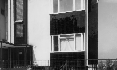
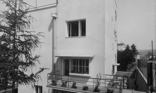
The New House exhibition estate in many ways helped usher in the housing development of the years to come. After the outbreak of the global economic crisis in 1929, architects shifted their attention to affordable housing. Žabovřesky in the early 1930s saw Brno-based building companies erecting standardized, often terraced houses, which ensured low acquisition costs while satisfying all requirements for modern housing (especially the houses in Zábranského, Hvězdárenská, Lužická, Březinova streets and in Šmejkalova Street below the Wilson Wood). However, the demand for villas and detached houses did not die out completely in the years of the crisis and started to grow again in the economic boom of the mid-1930s. Most villas of this period grew at the foot of Kraví Hill in present-day Krondlova, Foustkova and Wurmova streets, where they verged on the original Czech Officers' Quarter and Žabovřesky thus gradually and organically blended into the adjacent Masaryk Quarter.
The street network linking Žabovřesky with neighbouring Královo Pole was designed in the 1930s. However, only a small part of this design was implemented before World War II. Žabovřesky, therefore, did not expand northwards until the second half of the 20th century, when new estates grew at the foot of Palacký Hill and alongside the historic Královo Pole road.
Name
Žabovřesky 1918–1945
Length
4,4 KM
Number of objects
46
Trail Starts Here
Krondlova 611
First object
Small apartment building
C181
Public transport
Náměstí Míru (TRAM 4)
Barvičova (TROL 35, 39)
GPS
Download as GPX file
Download as KML file